A 1970s leaflet promoting Cromarty.
On a visit to Cromarty ~1972 with my parents. I picked this up at the Friendly Shop. Remember my parents talking to Alison and Alistair Dunn. I was interested in Geology and Hugh Millers house....
Date Added: 17 July 2025

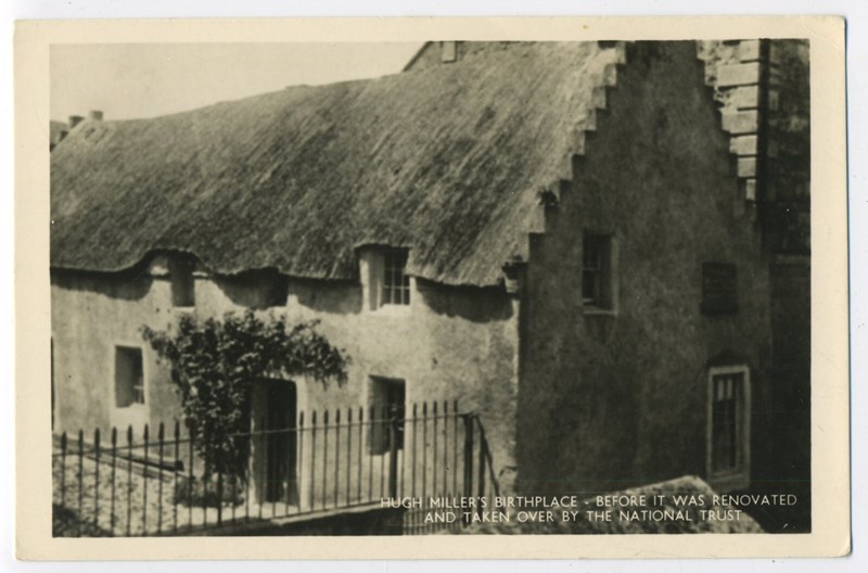
Hugh Miller's Cottage before the National Trust
Does anyone know when the NTS took over the cottage?...
Date Added: 11 July 2025
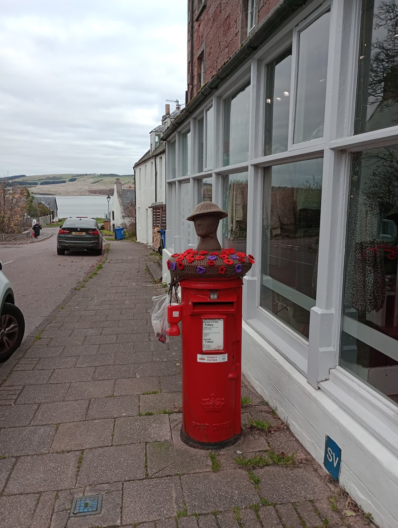
Postbox dressed for Armistice Day
...
Date Added: 04 November 2024
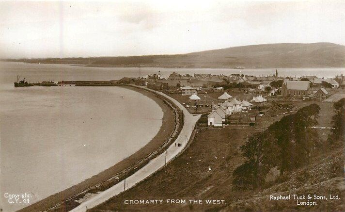
View of the town from the west
A postcard showing the town from the west c1955. Bayview is under construction....
Date Added: 31 October 2024
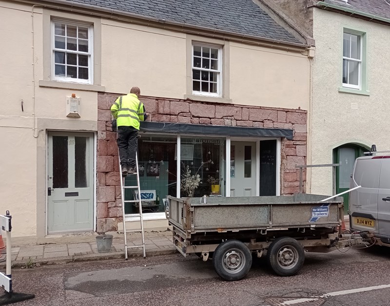
Emporium Stonework
The sandstone around the former Emporium window exposed after removal of harling....
Date Added: 29 August 2024
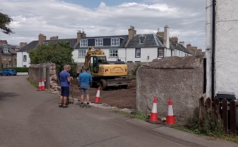
Building work in the old bank house garden.
In order to fulfil Highland Council's policy of providing two car parking spaces for any new house the wall here has been knocked...
Date Added: 29 July 2024
Urquhart Domestic Bakery
Alexander Urquhart was my great-great uncle. He came from Cromarty to Concord Massachusetts and started a bakery. "Urquhart Domest...
Date Added: 26 June 2024
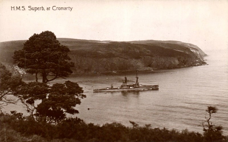
HMS Superb at Cromarty c1910
...
Date Added: 22 November 2023
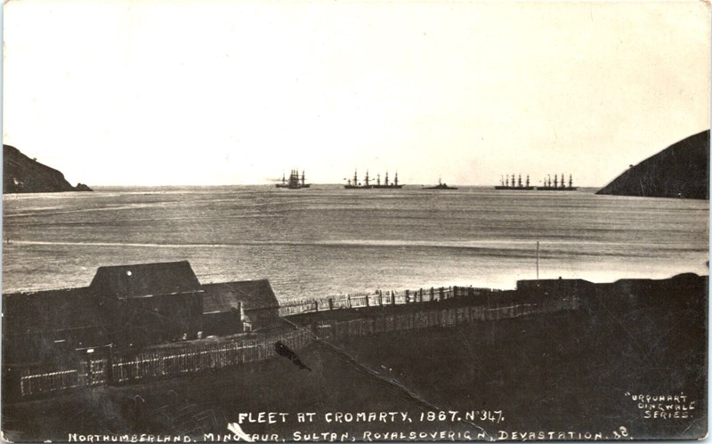
Fleet at Cromarty 1867
This seems to be another version of picture #2968, but this one shows the fleet and details of the stockade around the buildings i...
Date Added: 22 November 2023
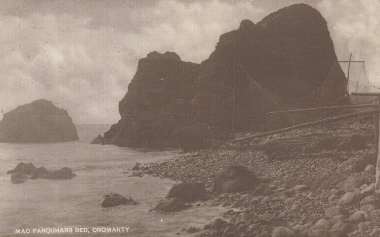
Macfarquar's Bed - c1900
Taken from the shore to the north it shows bagnets hung up to dry....
Date Added: 07 November 2023
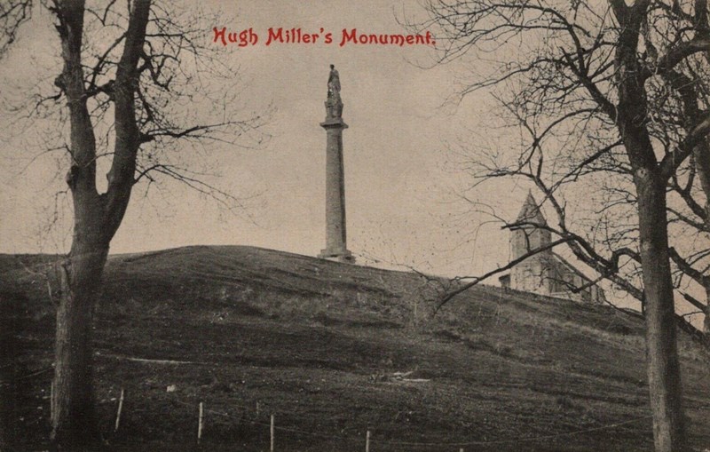
Hugh Miller's Monument - c1890
No trees or bushes on the Kirkie Brae and the roof of the Gaelic chapel looks to still be intact....
Date Added: 07 November 2023
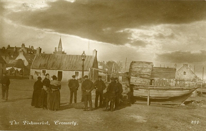
The Fishmarket, Cromarty - c1900
...
Date Added: 07 November 2023
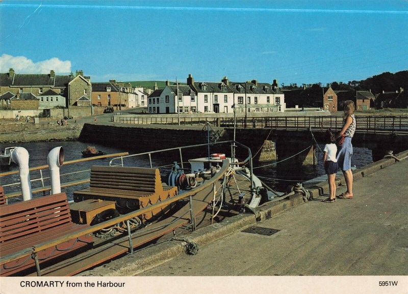
Cromarty from the Harbour - c1980
Postcard taken around 1980 with the id 5951W.
Shows the deck of one of the Hifab ferries. Also note the central building in the...
Date Added: 07 November 2023
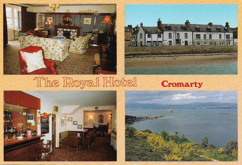
Postcard of the Royal Hotel, Cromarty
Postcard showing the lounge, the frontage, the lounge bar and a view from the Sutor. Date estimated based on the jetty in the last...
Date Added: 20 June 2023
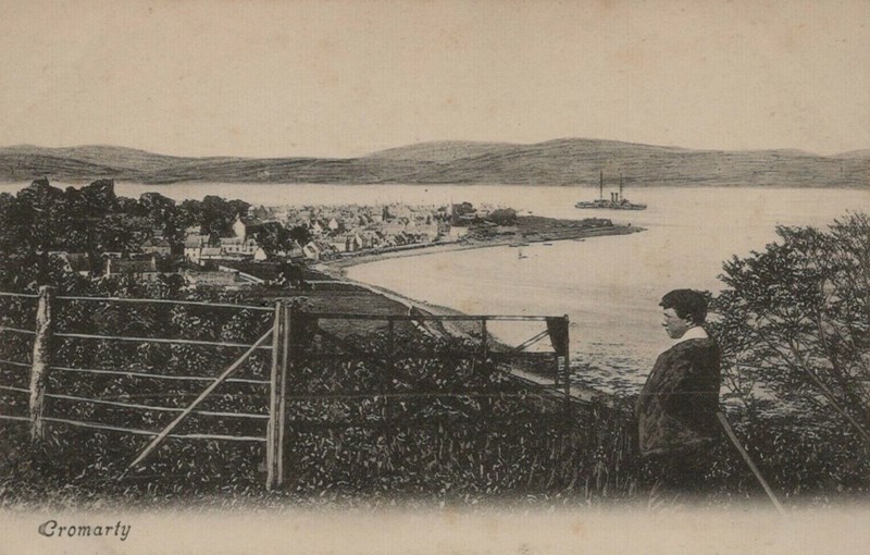
View of Cromarty from the South Sutor
Postcard showing a young man viewing the town from around half way up the South Sutor....
Date Added: 10 April 2023
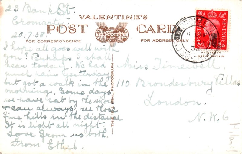
Reverse of Postcard - 'Cromarty from South Soutar'
Postcard sent from 23 Bank St in 1938, the reverse of picture #2877.
Sent on 20th July, 1938, it says:
"Hope all goes well w...
Date Added: 03 March 2023
Comments
My father knew Donald Ross and used to keep his boat next to Donald's boat shed at Crinan old harbour. At the time Donald Ross owned two boats called The Look A Are Annie & Bella Dhu sisters of Catherine Macleman or anyone know how related? My 2nd great Grandmother Elizabeth (Betsy) Hebner nee Gilmour worked at the house as a laundress in 1882 after the death of her husband John Henry (Harry) Hebne Very interesting photo but if it's the Youngs as Flora says it must be a bit older than 1950 because William Young died in 1941 and his wife Ann or Annie died i These vessels were part of the RAF Marine Craft Unit (MCU) whose primary role was Search & Rescue (SAR). We used to love watching them cruise in and out of the I also worked for about 8 months on the Ninian Northern, a massive jacket. On the night of its launch the Teflon slipway failed and all the welders had to come This is a photo of my grandfather. My Mum, Valerie Mackenzie, was one of four children from his first marriage. She immigrated to NZ before I was born so I sadl The man in the photograph is my great grandfather. My grandmother was his daughter Jane and her name appears on the gravestone of Robina Gordon Mackenzie and Jo Cova Green is described by Hugh Miller at the start of chapter 12 of "Scenes and Legends of the North of Scotland". Hello James Andrew Bain, Shirley Alsop, (William) Douglas Bain, I am interested in knowing more about the Donald Bain family at Rosefarm. I'm wondering if any My lovely Gran, Annie Davie. So many good memories of staying with her over the holidays. Still missed. Pretty sure that is Charlie Young second from the end. His shirt is the Fortrose Academy rugby team. My mum was Miss Vicky's nanny before she married my dad. Her mother passed away when she was 16 and she went into the Land Army. She was under 5" and weighed 86 Isa & George were my Aunt & Uncle. I am the son of Andrew Thomson, George's brother. I'm in Scotland on a road trip & would love to track down Billy or Irene + My late husband John Bremner grew up at 68 Big Vennel with his grandparents and his aunt Jean Bremner. I wondered what happened to the house. I'm not sure but the one on the left might be my dad, Ivor Ross. Hard to tell. #31 is definitely Ivor Ross (my dad) Daniel Hossack I believe was my great grandfather. My father was Donald Hossack D.O.B. 03.08.1935 lived in the rd called The Big Fennal. I think these are Youngs. Gentleman on left is either Jim or Jack Young and I think the couple to the right could be my father's grandparents. The other lady a I believe my Dad was rescued by the crew of the Cromarty lifeboat in the late 1950s. The crew rescued the men from the MV Servus. Can anyone give me further pa